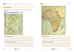
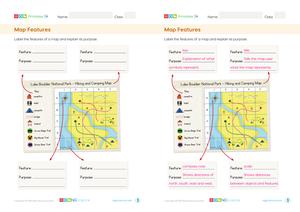
Maps have features that provide people with accurate information about the area they represent. Some features include a title, symbols, a key and a scale. Some maps also have grids that can be used to find the location of things on the map.
The title tells people what the area on the map represents. It may also include what the intended use of the map is.
The title of the map tells us its a map of a National Park.
Symbols are used on maps to represent the locations of things. Symbols are usually simple and easy for the map reader to understand what they represent. A key is often used to provide an explanation of what the symbols represent. A key can also be called a legend.
Symbols are often used to show the location of objects and places.
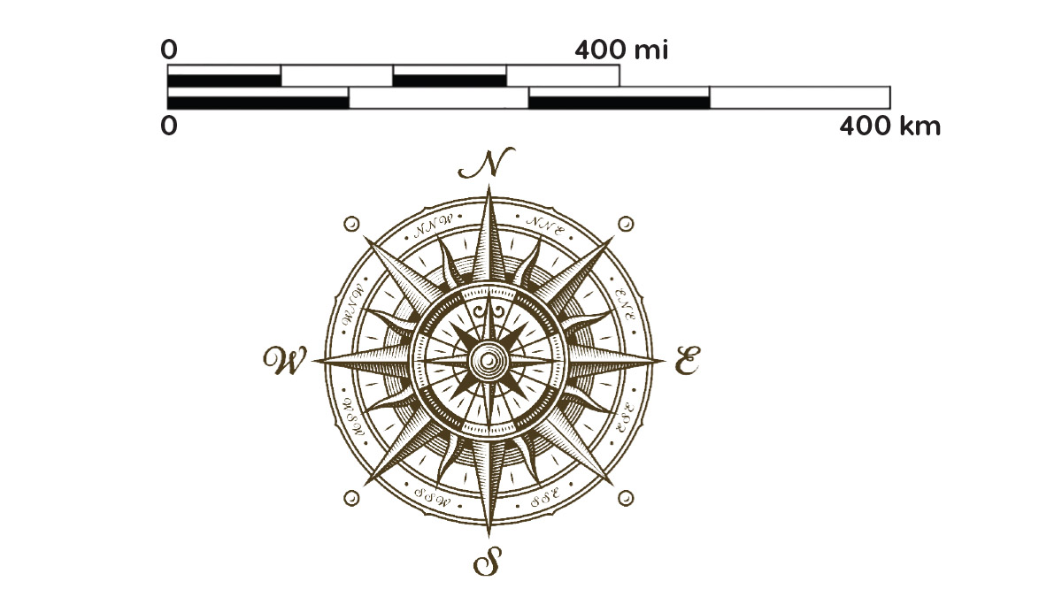
A scale shows the distance between objects on the map. Often, the scale is in the form of a bar with distances at different intervals marked. A scale also includes the units of measurement, such as kilometers or meters.
A compass rose is a feature on most maps that shows the directions of north (N), south (S), east (E) and west (W). Common practice is for a map to show an area with north pointing up.
The function of the scale on a map is to show the distance between points in the real world, while the compass rose indicates the directions (North, East, South, and West) to help orient the map correctly.