In science, finding patterns is very useful. A pattern is something that repeats over and over. They can be used to help explain why something is occurring and also to make predictions about where or when it may occur again. Meteorologists are scientists that look for patterns in the weather. When a pattern is identified, it can be used to make predictions about the weather in the future. Scientists have identified patterns in the Earth’s landforms. Mountains are landforms that often appear in groups, called mountain ranges. Scientists have observed a pattern whereby many mountain ranges occur at the places where the Earth’s plates meet.
This pattern helps with the explanation that mountains form when the boundaries of the plates interact as they bump and slide against each other. The interactions cause the crust to buckle or push upwards.
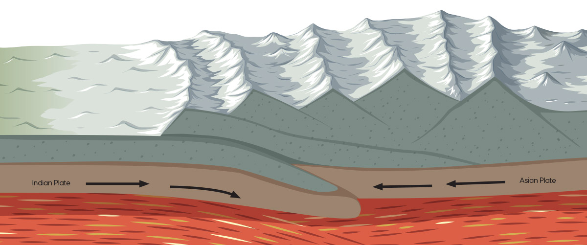
The Himalayan Mountain Range, for example, was created due to the collision of the Indian and Asia tectonic plates.
The Himalayan Mountain Range, which includes the Earth's tallest mountain, Mount Everest, was created due to the collision of the Indian and Asia tectonic plates.
As with the formation of mountains on the Earth’s surface, earthquakes and volcanic eruptions also occur in identifiable patterns. They both occur in cracks in the Earth’s crust, called faults. The largest faults occur at plate boundaries. There are also faults within plates.
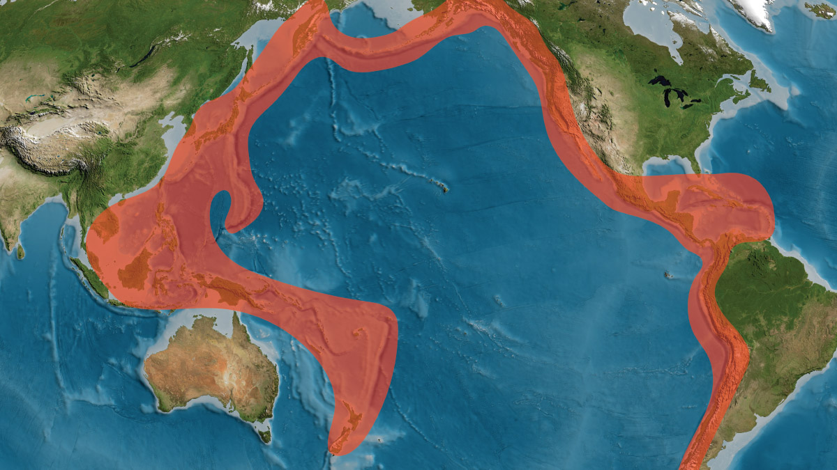
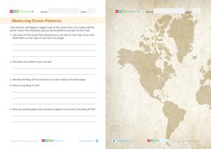
By putting the location of earthquakes and volcanic eruptions on a map, scientists observed that many occur along plate boundaries and faults around the Pacific Ocean. The area is known as the Ring of Fire. About 90 percent of volcanic eruptions on Earth occur in the Ring of Fire.
The Ring of Fire is a major area in the Pacific Ocean where a large number of earthquakes and volcanic eruptions occur due to the boundaries of several tectonic plates.
The pattern of earthquake and volcanic activity around the Ring of Fire helps scientists explain why, where and when such events occur.